Next-generation Earth Measurement For The AI Era


L3Harris Technologies and Xoople have created an advanced spaceborne measurement platform engineered for an era shaped by artificial intelligence, Earth observation, and high-value information drawn from remote sensing across outer space.
Building a Planet-Scale Data Foundation
The partnership is rooted in a common view that the future of Earth intelligence will rely on rigorous measurement, trusted data handling, and modern technology built to operate at global scale through a resilient system and database architecture. In that model, satellite-derived information supports:
- Landscape observation
- Forest monitoring
- Ecosystem analysis
- Ice coverage assessment
- Wind measurement
- Vegetation health monitoring
- Canopy structure analysis
- Topography mapping
- Elevation and height measurement
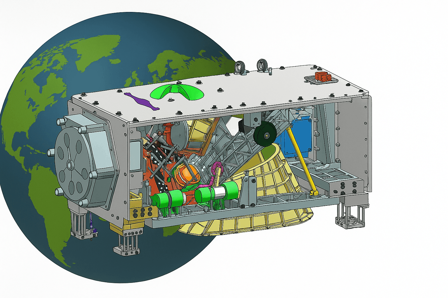
At the center of the program is a satellite constellation designed to produce data at roughly 100x beyond today’s gold standard, establishing a persistent measurement layer for Earth. This spacecraft network and broader constellation concept are intended to serve as a dependable system of record, giving AI models a more reliable map of the physical world and a stronger ratio of signal to uncertainty. Achieving that kind of global coverage typically depends on coordinated orbital spacing, repeat ground tracks, frequent revisit cycles, and data delivery pipelines that keep latency low enough for time-sensitive analysis. Persistent measurement at scale also requires stable calibration, high onboard power efficiency, and data rates that can support continuous collection across wide geographic areas. The approach can support research, calibration, and simulation workflows for parameters tied to digital elevation model production, communication planning, and environmental observation in cloud-variable conditions.
Advancing Precision Monitoring From Space
This effort builds on L3Harris expertise in precision sensing, remote sensing technology, and integrated space systems. The imaging sensor payloads developed in Rochester, New York, are designed to deliver the optical quality, measurement stability, and geospatial fidelity required for AI-ready Earth observation data.
| Discipline | Application in Spaceborne Measurement |
|---|---|
| Radar | Supports surface imaging and change detection across broad areas |
| Synthetic-aperture radar | Improves imaging performance in low-visibility conditions and through cloud cover |
| Lidar | Measures elevation, canopy height, ice profiles, and other three-dimensional features |
| Laser ranging | Provides precise distance measurements between instrument and surface |
| Altimeter development | Enables elevation profiling for land, ice, and water surfaces |
| Radio frequency design | Supports reliable signal transmission and instrument performance |
| Beamforming | Improves directional sensing and communication efficiency |
| Phased array architecture | Enhances targeting, sensing flexibility, and signal control |
| Antenna array performance | Strengthens measurement quality and communications stability |
| Antenna engineering | Supports payload integration for satellite and aircraft missions |
Such capabilities are relevant to missions that track Earth surface change, support ICESat-style elevation analysis, and improve map creation through computer simulation and calibrated observation. In practice, these measurements support topography mapping, biomass estimation, ice sheet monitoring, and forest structure analysis, producing better terrain models, more accurate carbon estimates, and clearer records of environmental change. They also contribute to better understanding of forest structure, canopy patterns, vegetation health, ice coverage, and even cell-level environmental response in sensitive ecosystems, while strengthening license-ready and communication-focused mission planning across hertz-defined operating bands in radio systems.Persistent, high-accuracy spaceborne measurement gives AI systems a more dependable physical baseline for interpreting change across the planet.
Together, the companies are positioning this space-based technology as a trusted source of measurement and information for artificial intelligence, enabling better calibration, stronger research outcomes, and more dependable understanding of the planet through persistent observation from space.
LiDAR Types Used in Spaceborne Measurement
Spaceborne lidar systems are designed for different sensing objectives, and the choice of method affects what kind of information can be captured from orbit.
- Waveform lidar: Records the full returned energy profile, making it useful for measuring vertical structure in forests, ice surfaces, and complex terrain.
- Discrete return lidar: Captures distinct return points from surfaces such as the ground, canopy top, or built features, supporting elevation mapping and surface modeling.
- Photon-counting lidar: Detects individual photons, allowing highly sensitive measurements with lower pulse energy and making it well suited to large-scale elevation missions.
- Doppler lidar: Measures frequency shifts in returned light to estimate wind speed and direction in the atmosphere.
Each type serves a different use case. Waveform systems are often preferred when vertical structure matters most, discrete return systems help isolate surface layers, photon-counting systems are valuable for global coverage with fine elevation sensitivity, and Doppler systems are used when atmospheric motion is the main target.
Instrument Configuration and Signal Detection
A typical spaceborne lidar instrument includes a laser transmitter, pointing and timing electronics, a telescope to collect reflected energy, detectors to register the return signal, and onboard processing systems to organize the measurements. The system emits laser pulses toward Earth, the surface or atmosphere reflects part of that energy back to the spacecraft, and the detector measures the return time and signal strength. From that timing, the instrument can calculate distance, while the shape or frequency of the returned signal can reveal height, structure, or motion.
In Doppler lidar systems, wind fields are measured through the Doppler effect. When laser light is scattered back by particles moving with the air, the returned frequency shifts slightly. By comparing the transmitted and received signal, the instrument can derive wind speed along the line of sight, and repeated measurements from different viewing geometries help estimate wind direction and broader wind-field structure.
Challenges and Limitations of Spaceborne LiDAR Systems
Spaceborne lidar offers precise measurement capability, but it also faces practical limits. Signal attenuation can reduce performance when laser energy is weakened by clouds, aerosols, or atmospheric moisture. Power constraints are significant because orbital systems must balance instrument performance with spacecraft energy budgets, thermal control, and mass limits. Orbital geometry also affects coverage, revisit time, and viewing angle, which can limit how often a location is measured.
Environmental conditions remain a major factor. Cloud cover and atmospheric interference can block or distort returns, especially for surface-focused observations. Data processing and calibration are equally important, since accurate results depend on stable timing, detector sensitivity, geolocation quality, and cross-calibration over time. Without careful calibration, even highly advanced instruments may produce inconsistencies that reduce long-term value for research and operational use.
Applications and Outcomes of Spaceborne LiDAR Data
Spaceborne lidar data supports a wide range of terrestrial and climate-related applications. On land, it is used for land cover mapping, disaster response, urban planning, agriculture, forest inventory, and infrastructure assessment. These measurements help identify flood-prone terrain, monitor wildfire impacts, improve crop and vegetation analysis, and support more detailed planning in rapidly changing built environments.
For climate change and cryospheric monitoring, lidar helps track ice sheets, glaciers, sea ice, surface elevation change, and related indicators tied to sea-level rise and long-term environmental shifts. The outcomes include more accurate change detection, stronger baseline maps, better estimates of biomass and stored carbon, and improved understanding of how ecosystems and frozen regions evolve over time.
Current and Future Missions Using LiDAR Technology
Several notable missions show how lidar has been used in practice and where it may go next.
- ICESat: Focused on ice sheet elevation, sea ice, and land topography.
- ICESat-2: Expanded elevation monitoring with photon-counting measurements for ice, vegetation, and inland water studies.
- GEDI: Measures forest vertical structure and biomass from orbit.
- CALIPSO: Studies aerosols and clouds in the atmosphere.
- Aeolus: Used Doppler lidar to observe global wind profiles.
These missions demonstrate how lidar can support cryospheric science, atmospheric observation, ecosystem monitoring, and global elevation mapping. Future systems are expected to build on those objectives with broader coverage, faster revisit times, and tighter integration with AI-driven analysis workflows.
Requirements for a Global Spaceborne LiDAR System
A global system must balance coverage, precision, and operational efficiency. Key requirements include revisit frequency sufficient for tracking change, spatial resolution matched to the target application, and latency low enough to support research or decision-making needs. Technical requirements include reliable onboard power, efficient data handling, stable calibration, precise timing, and instrument durability over long mission lifetimes.
For a persistent global measurement layer, the system also needs well-planned orbital coverage, scalable ground processing, and consistent reference standards so measurements remain comparable across time, regions, and instruments.


